All images and descriptions are courtesy of PDXHistory.com
HISTORY OF LENTS
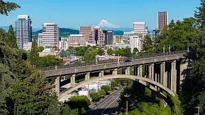
The Lents neighborhood in the Southeast section of Portland, Oregon is bordered by SE Powell Blvd. on the north, the Clackamas County line or City of Portland line on the south (whichever is farther south), SE 82nd Ave. to the west, and roughly SE 112th on the east. The NE corner overlaps with the Powellhurst-Gilbert neighborhood. In addition to Powellhurst-Gilbert on the north and east, Lents also borders Foster-Powell, Mt. Scott-Arleta, and Brentwood-Darlington on the west and Pleasant Valley on the east.
The neighborhood is one of the larger in the city at 3.75 square miles (9.7 km2); one of its oldest; and one of its most diverse, with many Asian, Russian/Eastern European, and Latino immigrants,[2][citation needed].
Lents is six miles (10 km) southeast of downtown Portland and lies within the 97266 ZIP code.
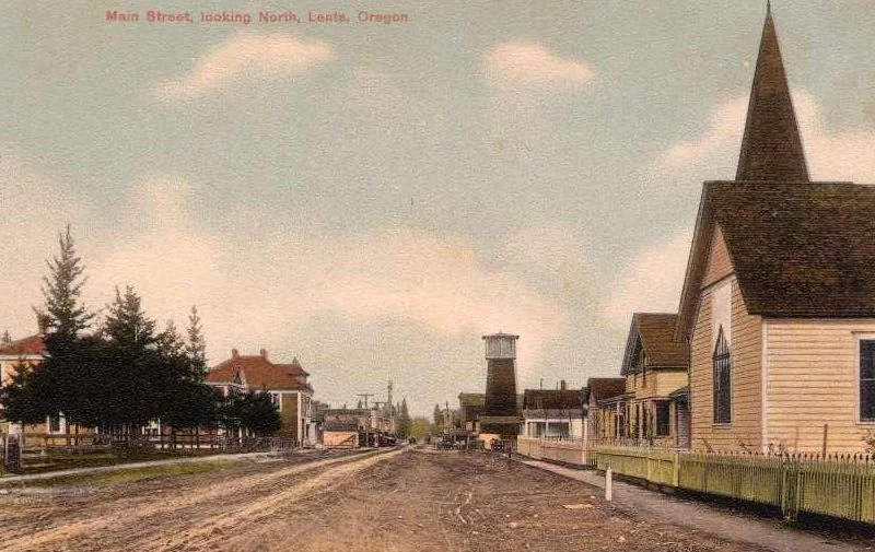
Main Street Looking North in Lents.
Oliver Lent built and operated a sawmill for many years. He served as school director, road supervisor and justice of the peace. Oliver Lent died in 1899. Oliver Lent's town was originally built as a self-sufficient town and suburb of Portland. As Portland grew and absorbed other smaller towns, Lents was annexed into the City in 1912.
A little video of the history of Lents and it's current development.
History
Lents was originally platted as the Town of Lent by Oliver P. Lent (1830–1899) in 1892. The original town was bounded by SE Foster Rd., SE Duke St., SE 92nd Ave, and SE 97th Ave.
Lent's town was originally built as a self-sufficient town and suburb of Portland. In 1912, with a population nearing 10,000, Lents was annexed into the city of Portland.[3] Because of its distance from central Portland and lower income class, it was repeatedly neglected by the city in terms of street and sewer improvements.[3] The I-205 Freeway was originally destined for 39th Avenue, but the powerful residents of Portland's Laurelhurst neighborhood successfully lobbied to have the path changed to 52nd Avenue. By the time it came to final planning the city had grown and decided to move the freeway's path further out to 95th Avenue, effectively cutting the Lents neighborhood in half.[citation needed]In contrast, Maywood Park was able to establish itself as its own city and sued to stop construction of the freeway and a compromise was eventually reached.
Demographics
As of the 2010 Census, Lents had a population of 20,156. It was 60.1 percent white, 14.1 percent Asian, 4.5 percent black, 1.0 percent Native American, with 3.7 percent of census respondents identifying as two or more races. 15.8 percent of census respondents identified as Hispanic or Latino.
Transportation
Lents is a transportation hub for the Portland region. Interstate 205 and three of Portland's important arterials—Powell Boulevard, Foster Road and 82nd Avenue—pass through the neighborhood, as well as the MAX Green Line and the Springwater Corridor pedestrian and bike trail.
I-205 freeway cuts through the center of the original town, where SE 92nd Avenue, which was only a half mile east of 82nd avenue, the original road to Oregon City, met SE Foster Road, which led to Foster's Farm. Beginning in 1892, a streetcar ran from downtown Portland. The route traveled from downtown across the Hawthorne Bridge to SE 50th Avenue. At SE 50th, an extant curve in the road shows the route going south. SE 50th Avenue runs into SE Foster Road. The trolley continued on SE Foster to SE 72nd Avenue, bearing south. Another extant curve to the left at Gray's Corner sent the trolley east on SE Woodstock Boulevard. This road was followed through to the curve at 97th which sent it into the neighborhood south of SE Foster Road. After several more blocks, the line ended at SE 100th Avenue where it met the interurban line that once occupied what is now called the Springwater Corridor. The interurban line continued to points east, ending in Estacada.
Lents Town Center MAX Station along the Green Line
Lents is served by the following TriMet bus lines:
9-Powell Blvd
10-Harold St
14-Hawthone
17-Holgate/Broadway
19-Woodstock/Glisan
71-60th/122nd Avenue
72-Killingsworth/82nd Avenue
Future
In recent years, Portland has seen the potential value of the Lents neighborhood and established it as an Urban Renewal Area, which allows the city to bond on future increases in property tax revenues to fund capital projects throughout the Lents Town Center Urban Renewal Area. Many new homes and businesses have been established and more are planned. The MAX light rail system has been expanded southward from the Gateway hub, along I-205 to the Clackamas Town Center.
Another great historical website that was shared with us.
And another Lents History created by Jason Bird